Category:18th-century maps of France
Countries of Europe: Albania · Armenia‡ · Austria · Azerbaijan‡ · Belarus · Belgium · Bosnia and Herzegovina · Bulgaria · Croatia · Cyprus‡ · Czech Republic · Denmark · Estonia · Finland · France‡ · Georgia‡ · Germany · Greece · Hungary · Iceland · Republic of Ireland · Italy · Latvia · Lithuania · Luxembourg · Malta · Moldova · Montenegro · Netherlands‡ · North Macedonia · Norway · Poland · Portugal‡ · Romania · Russia‡ · Serbia · Slovakia · Slovenia · Spain‡ · Sweden · Switzerland · Turkey‡ · Ukraine · United Kingdom
Specific status: Gibraltar · Isle of Man – Limited recognition: Abkhazia‡
‡: partly located in Europe
Specific status: Gibraltar · Isle of Man – Limited recognition: Abkhazia‡
‡: partly located in Europe
Subcategories
This category has the following 31 subcategories, out of 31 total.
#
.
A
B
C
- 18th-century maps of Corsica (71 F)
L
- 18th-century maps of Loire River (10 F)
- 18th-century maps of Lyon (29 F)
N
O
- 18th-century maps of Orne (9 F)
P
T
Media in category "18th-century maps of France"
The following 42 files are in this category, out of 42 total.
-
 1 cartographie comparaison échelles.jpg 1,389 × 957; 463 KB
-
 Map - Special Collections University of Amsterdam - OTM- HB-KZL 32.25.30.tiff 7,340 × 6,337; 133.08 MB
-

-

-
 Baai von Bourneuf.jpg 1,810 × 2,133; 1.01 MB
-
 Belmont-940x684.jpg 940 × 684; 212 KB
-
 Blois - Percement avenue Wilson 18e siècle.png 754 × 672; 1.24 MB
-
 Ladors-02.jpg 1,816 × 2,912; 1.3 MB
-

-
-
 Capture-d c3a9cran-2014-02-26-c3a0-17-43-02.jpg 853 × 735; 370 KB
-
 Carte Baie d'Audierne 2e moitié XVIIIe.jpg 642 × 485; 132 KB
-

-
 Carte de la Loire (de Nantes à son embouchure) Aoust 1720 - btv1b532098645.jpg 12,340 × 4,389; 7.96 MB
-
 Carte de Portsall fin XVIIIe.jpg 438 × 572; 169 KB
-
 Carte Primelin fin XVIIIe.jpg 977 × 606; 286 KB
-
 Douarnenez fin XVIIIème siècle(Gallica Archives Nationales).jpg 1,376 × 1,381; 1.69 MB
-
-
 Faubourg de Marne et remparts carte de Chastillon.jpg 1,728 × 751; 546 KB
-
 Ile de Bréhat et entrées de rivière du Trieux - Grenier - btv1b531538952.jpg 11,162 × 7,390; 6.38 MB
-
 Kriegs-Theather am Rhein - btv1b10224828n.jpg 8,931 × 6,478; 10.62 MB
-
 L'Historiographie du royaume de France (BM 1893,0331.109).jpg 2,500 × 1,957; 1.26 MB
-

-
 Landunvez fin XVIIIe carte.jpg 896 × 476; 233 KB
-
 Le Theil-Nolent plan 18e siècle.jpg 1,151 × 1,188; 589 KB
-
 Paroisse de Plémeur carte date inconnue.jpg 1,195 × 969; 542 KB
-
 Partie du Dauphiné - (par Jean-Baptiste d'Anville) - btv1b530091031.jpg 3,634 × 3,150; 1.25 MB
-

-
 Plan d'alignements des bastions sud-ouest de Vannes 2nd 18ème.png 808 × 492; 1.21 MB
-
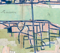
 Plan de l'hopital général de la ville de Rennes.jpg 12,332 × 11,868; 13.35 MB
-
 Plan de la ville et chateau de Nantes en Bretagne - Beaurain - btv1b8591961w.jpg 4,144 × 3,136; 2.56 MB
-
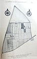
 Plan de masse du Vieil Ecouché-copy.jpg 800 × 600; 118 KB
-
 Plovan carte ancienne fin XVIIIe.jpg 936 × 1,232; 604 KB
-
 Pont Saint-Vincent (Vannes).jpg 768 × 512; 309 KB
-
 Port-Louis Plan du XVIII siècle.jpg 544 × 428; 163 KB
-
 Provins gravure Chastillon.jpg 640 × 403; 198 KB
-
 RENNES-PLAN du 18e siècle La Moussaye.jpg 1,371 × 1,362; 568 KB
-
 RENNES-PLAN MOUSSAYE du 18e siècle.jpg 972 × 1,434; 453 KB
-
 18e s.-Plan de Saint-Benoît-sur-Loire.JPG 410 × 300; 28 KB
-
 Sainte-Maure-de-Touraine Carte de Cassini.jpg 771 × 503; 129 KB
-
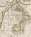
 Île d'Ouessant - btv1b531532107.jpg 7,442 × 4,990; 3.41 MB
-
 Île d'Ouessant - btv1b53153226b.jpg 6,360 × 4,252; 2.91 MB

_;_H._Van_Loon_sculp_-_btv1b530328911.jpg)
.jpg)


.jpg)
.jpg)


.jpg)


.jpg)


_-_btv1b530091031.jpg)


.jpg)


_Aoust_1720_-_btv1b532098645.jpg)