Category:18th-century maps of Norway
Countries of Europe: Albania · Armenia‡ · Austria · Azerbaijan‡ · Belarus · Belgium · Bosnia and Herzegovina · Bulgaria · Croatia · Cyprus‡ · Czech Republic · Denmark · Estonia · Finland · France‡ · Georgia‡ · Germany · Greece · Hungary · Iceland · Republic of Ireland · Italy · Latvia · Lithuania · Luxembourg · Malta · Moldova · Montenegro · Netherlands‡ · North Macedonia · Norway · Poland · Portugal‡ · Romania · Russia‡ · Serbia · Slovakia · Slovenia · Spain‡ · Sweden · Switzerland · Turkey‡ · Ukraine · United Kingdom
Specific status: Gibraltar · Isle of Man – Limited recognition: Abkhazia‡
‡: partly located in Europe
Specific status: Gibraltar · Isle of Man – Limited recognition: Abkhazia‡
‡: partly located in Europe
Subcategories
This category has the following 10 subcategories, out of 10 total.
#
Media in category "18th-century maps of Norway"
The following 8 files are in this category, out of 8 total.
-
 Atlas - no-nb krt 00758.jpg 11,916 × 7,547; 25.5 MB
-
 Atlas - no-nb krt 00759.jpg 9,138 × 7,853; 22.5 MB
-
 Christiansteens festning - no-nb krt 00593.jpg 6,725 × 5,537; 12.85 MB
-
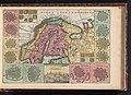 Kaart van Zweden Kaart van Sweden Royaume de Suede (titel op object), BI-B-FM-090-87.jpg 3,576 × 2,580; 1.76 MB
-

-
 Nova et accurata tabula episcopatvvm Stavangeriensis, Bergensis et Asloiensis LOC 2001620497.tif 7,119 × 6,009; 122.39 MB
-

-


,_BI-B-FM-090-87.jpg)

,_RP-P-1896-A-19368-3020.jpg)
,_RP-P-1896-A-19368-3022.jpg)