Category:18th-century maps of Spain
Countries of Europe: Albania · Armenia‡ · Austria · Azerbaijan‡ · Belarus · Belgium · Bosnia and Herzegovina · Bulgaria · Croatia · Cyprus‡ · Czech Republic · Denmark · Estonia · Finland · France‡ · Georgia‡ · Germany · Greece · Hungary · Iceland · Republic of Ireland · Italy · Latvia · Lithuania · Luxembourg · Malta · Moldova · Montenegro · Netherlands‡ · North Macedonia · Norway · Poland · Portugal‡ · Romania · Russia‡ · Serbia · Slovakia · Slovenia · Spain‡ · Sweden · Switzerland · Turkey‡ · Ukraine · United Kingdom
Specific status: Gibraltar · Isle of Man – Limited recognition: Abkhazia‡
‡: partly located in Europe
Specific status: Gibraltar · Isle of Man – Limited recognition: Abkhazia‡
‡: partly located in Europe
Subcategories
This category has the following 17 subcategories, out of 17 total.
Media in category "18th-century maps of Spain"
The following 28 files are in this category, out of 28 total.
-
 Carte des présides espagnols.jpg 5,500 × 3,484; 2.28 MB
-

-
-
 Alicante. - Plan de la ville et château d'Alicant - btv1b8445510t.jpg 9,658 × 6,444; 6.14 MB
-

-
 Balneario Jabalcuz Serafín de Alcázar.png 2,700 × 2,168; 207 KB
-

-
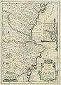 Carte du Royaume de Valence - Gravée par Inselin - btv1b5971911s.jpg 2,969 × 4,100; 1.55 MB
-
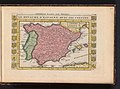
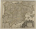 Carte générale des royaumes d'Espagne et de Portugal... - btv1b8442434z.jpg 9,897 × 7,968; 13.85 MB
-

-
-
 Cartografie in Nederland, kaart van Spanje en Portugal, NG-501-48.jpg 5,754 × 4,886; 5.86 MB
-
 Croquis de la Isla del Perejil.jpg 296 × 450; 55 KB
-

-
 Kaart van het zuiden van Spanje en Portugal, RP-P-1896-A-19368-3004.jpg 6,602 × 5,448; 6.43 MB
-

-
-
 Kaart van Spanje, objectnr A 16213.jpg 7,991 × 6,698; 40.3 MB
-
 Kaart van Spanje, RP-P-1938-1301.jpg 6,304 × 4,490; 4.03 MB
-

-
 Les Royaumes de Valence et de Murcie - Par N. de Fer - btv1b53056476x.jpg 6,056 × 7,880; 7.02 MB
-
 Map of Tenerife.jpg 800 × 640; 115 KB
-
 Nouveau plan de Gibraltar - Jean Covens et Corneille Mortier.jpg 1,276 × 1,107; 759 KB
-

-
 Plan de Carthagene en Murcie.jpg 6,845 × 5,174; 9.18 MB
-
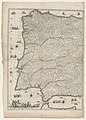 Péninsule ibérique. Espagne et Portugal - partie occidentale - btv1b530937768.jpg 7,823 × 10,943; 15.73 MB
-

-
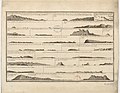
 Zeekaart van een deel de Golf van Biskaje bij Bilbao.jpeg 2,500 × 2,175; 817 KB


.jpg)

_Les_Principales_Forteresses_%26_Villes_Fortes,_d%27Espagne,_de_France,_d%27Italie,_de_Savoi,_RP-P-2015-62-9.jpg)


,_RP-P-1911-3087.jpg)

,_RP-P-2018-1135.jpg)
,_BI-B-FM-090-59.jpg)


,_RP-P-1896-A-19368-3060.jpg)
