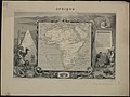
Category:19th-century maps of Africa
Temperate regions: North America · South America · Africa · Europe · Asia · Oceania – Polar regions: Antarctica · Arctic – Other regions:
Countries of Africa: Algeria · Angola · Benin · Botswana · Burkina Faso · Burundi · Cameroon · Cape Verde · the Central African Republic ≈ Central African Republic · Chad · the Comoros ≈ Comoros · the Democratic Republic of the Congo ≈ Democratic Republic of the Congo · the Republic of the Congo ≈ Republic of the Congo · Djibouti · Egypt‡ · Equatorial Guinea · Eritrea · Eswatini · Ethiopia · Gabon · the Gambia ≈ Gambia · Ghana · Guinea · Guinea-Bissau · Ivory Coast · Kenya · Lesotho · Liberia · Libya · Madagascar · Malawi · Mali · Mauritania · Mauritius · Morocco · Mozambique · Namibia · Niger · Nigeria · Rwanda · São Tomé and Príncipe · Senegal · the Seychelles ≈ Seychelles · Sierra Leone · Somalia · South Africa · South Sudan · Sudan · Tanzania · Togo · Tunisia · Uganda · Zambia · Zimbabwe
Limited recognition: Ambazonia · Azawad · Puntland · the Sahrawi Arab Democratic Republic ≈ Sahrawi Arab Democratic Republic · Somaliland – Other areas: Bir Tawil · the Canary Islands ≈ Canary Islands · Ceuta · Madeira · Mayotte · Melilla · Réunion · Saint Helena, Ascension and Tristan da Cunha · the Scattered Islands in the Indian Ocean ≈ Scattered Islands in the Indian Ocean · Western Sahara
‡: partly located in Africa
Subcategories
This category has the following 67 subcategories, out of 67 total.
- 1900 maps of Africa (19 F)
*
.
1
- 19th-century maps of the Red Sea (50 F)
A
B
- 19th-century maps of Benin (20 F)
C
- 19th-century maps of Cameroon (31 F)
- 19th-century maps of Cape Verde (46 F)
- 19th-century maps of Chad (10 F)
D
E
G
- 19th-century maps of Gabon (11 F)
- 19th-century maps of the Gambia (17 F)
- 19th-century maps of Ghana (37 F)
- 19th-century maps of Guinea (13 F)
I
- 19th-century maps of Ivory Coast (16 F)
K
L
- 19th-century maps of Lesotho (3 F)
- 19th-century maps of Liberia (92 F)
M
- 19th-century maps of Mali (12 F)
- Maps of Ottoman Algeria (35 F)
N
- 19th-century maps of Namibia (28 F)
- 19th-century maps of Niger (28 F)
- 19th-century maps of Nigeria (42 F)
S
T
- 19th-century maps of Tanzania (51 F)
- 19th-century maps of Togo (11 F)
U
Z
- 19th-century maps of Zambia (5 F)
Media in category "19th-century maps of Africa"
The following 28 files are in this category, out of 28 total.
-
 Senussi Map2.png 2,873 × 2,774; 2.09 MB
-
 A General History for Colleges and High Schools - Map 10 Part 2.png 1,934 × 3,181; 3.38 MB
-
 Africa (BM 1956,1018.49).jpg 2,500 × 1,870; 1.08 MB
-
 Africa (FL35469192 2370144).jpg 8,912 × 10,295; 116.29 MB
-
 Africa (Volume I) pg 20.jpg 1,826 × 2,114; 742 KB
-
 Africa (Volume I) pg 25.jpg 1,719 × 1,817; 362 KB
-
 Africa (Volume I) pg 28.jpg 1,796 × 1,863; 722 KB
-
 Africa (Volume I) pg 29.jpg 1,806 × 2,080; 1,021 KB
-
 Africa (Volume I) pg 32.jpg 1,798 × 2,233; 1 MB
-
 Africa (Volume I) pg 35.jpg 1,707 × 1,722; 597 KB
-
 Africa (Volume I) pg 36.jpg 3,569 × 2,415; 1.52 MB
-
 Africa (Volume I) pg 37.jpg 3,587 × 2,364; 1.37 MB
-
 Africa (Volume I) pg 45.jpg 1,795 × 2,316; 789 KB
-
 Africa (Volume I) pg 50.jpg 1,804 × 2,084; 1.09 MB
-
 Africa (Volume I) pg 54.jpg 1,804 × 1,871; 768 KB
-
 Africa (Volume I) pg 76.jpg 1,738 × 1,543; 229 KB
-
 Africa from Court Game of Geography MET DP862894.jpg 806 × 1,190; 316 KB
-
 Africa Map in Ottoman Turkish.jpg 8,174 × 5,795; 12.23 MB
-
 Africa-G.jpg 4,451 × 3,263; 8.63 MB
-
-
-
 Afrique, partie Nord - Sahara et Soudan - par M. Jomard - btv1b530329509.jpg 5,463 × 3,770; 1.93 MB
-
 Asante map.jpg 428 × 477; 95 KB
-
 Cameron - A travers l'Afrique 1881 - Carte-1.jpg 11,935 × 4,709; 7.34 MB
-
 Cameron - A travers l'Afrique 1881 - Carte-2.jpg 13,400 × 990; 2.12 MB
-
 Cameron - A travers l'Afrique 1881 - Carte.jpg 13,788 × 6,496; 10.55 MB
-

-


.jpg)
.jpg)
_pg_20.jpg)
_pg_25.jpg)
_pg_28.jpg)
_pg_29.jpg)
_pg_32.jpg)
_pg_35.jpg)
_pg_36.jpg)
_pg_37.jpg)
_pg_45.jpg)
_pg_50.jpg)
_pg_54.jpg)
_pg_76.jpg)


_de_fr%C3%A9gate,_pour_doubler_le_Cap_de_Bonne_Esp%C3%A9rance_pendant_la_saison_d%27hiver,_de_mai_%C3%A0_septembre_-_H._Bridet_-_btv1b531489751.jpg)