Category:Maps of Bois-Colombes
Arrondissement of Antony: Antony · Bagneux · Bourg-la-Reine · Châtenay-Malabry · Châtillon · Clamart · Fontenay-aux-Roses · Malakoff · Le Plessis-Robinson · Sceaux · Montrouge ·
Arrondissement of Boulogne-Billancourt: Boulogne-Billancourt · Chaville · Issy-les-Moulineaux · Marnes-la-Coquette · Meudon · Sèvres · Vanves · Ville-d'Avray ·
Arrondissement of Nanterre: Asnières-sur-Seine · Bois-Colombes · Clichy · Colombes · Courbevoie · Garches · La Garenne-Colombes · Gennevilliers · Levallois-Perret · Nanterre · Neuilly-sur-Seine · Puteaux · Rueil-Malmaison · Saint-Cloud · Suresnes · Vaucresson · Villeneuve-la-Garenne ·
Wikimedia category | |||||
| Upload media | |||||
| Instance of | |||||
|---|---|---|---|---|---|
| Category combines topics | |||||
| Bois-Colombes | |||||
commune in Hauts-de-Seine, France  .svg) _-_2022-10-22_-_1.jpg)  | |||||
| Instance of | |||||
| Location |
| ||||
| Head of government |
| ||||
| Inception |
| ||||
| Population |
| ||||
| Area |
| ||||
| Replaces | |||||
| official website | |||||
 | |||||
Media in category "Maps of Bois-Colombes"
The following 8 files are in this category, out of 8 total.
-
 92009-Bois-Colombes-Hydro.jpeg 5,846 × 4,133; 4.76 MB
-
 92009-Bois-Colombes-Sols.png 3,270 × 2,598; 8.77 MB
-

-
 Bois-Colombes - Asnières. Extrait des plans indicateurs de la banlieue - btv1b530619821.jpg 9,708 × 6,932; 8.97 MB
-
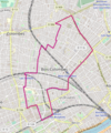 Bois-Colombes OSM 01.png 440 × 527; 248 KB
-
 Bois-Colombes OSM 02.png 441 × 519; 352 KB
-
 Carte du village de Bois de Colombes... - dressée par J. Devicque - btv1b8440504j.jpg 10,102 × 7,885; 8.41 MB
-
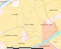 Map commune FR insee code 92009.png 756 × 605; 44 KB


_dans_son_EPT_de_La_Boucle_Nord_de_Seine_au_sein_de_la_M%C3%A9tropole_du_Grand_Paris.png)


