Category:Maps of Nanterre
Arrondissement of Antony: Antony · Bagneux · Bourg-la-Reine · Châtenay-Malabry · Châtillon · Clamart · Fontenay-aux-Roses · Malakoff · Le Plessis-Robinson · Sceaux · Montrouge ·
Arrondissement of Boulogne-Billancourt: Boulogne-Billancourt · Chaville · Issy-les-Moulineaux · Marnes-la-Coquette · Meudon · Sèvres · Vanves · Ville-d'Avray ·
Arrondissement of Nanterre: Asnières-sur-Seine · Bois-Colombes · Clichy · Colombes · Courbevoie · Garches · La Garenne-Colombes · Gennevilliers · Levallois-Perret · Nanterre · Neuilly-sur-Seine · Puteaux · Rueil-Malmaison · Saint-Cloud · Suresnes · Vaucresson · Villeneuve-la-Garenne ·
Wikimedia category | |||||
| Upload media | |||||
| Instance of | |||||
|---|---|---|---|---|---|
| Category combines topics | |||||
| Nanterre | |||||
commune in Hauts-de-Seine, France  .svg) _-_2023-09-09_-_1.jpg)  | |||||
| Instance of | |||||
| Location |
| ||||
| Located in or next to body of water | |||||
| Head of government |
| ||||
| Significant event |
| ||||
| Population |
| ||||
| Area |
| ||||
| Elevation above sea level |
| ||||
| official website | |||||
 | |||||
Media in category "Maps of Nanterre"
The following 10 files are in this category, out of 10 total.
-
 1778 – Plan détaillé du Bourg de Nanterre – Deuxième partie.jpg 13,066 × 8,368; 8.45 MB
-
 1778 – Plan détaillé du Bourg de Nanterre – Première partie.jpg 13,118 × 8,360; 8.94 MB
-
 92050-Nanterre-Hydro.jpeg 5,846 × 4,133; 5.22 MB
-
 92050-Nanterre-Sols.png 3,270 × 2,598; 9.27 MB
-
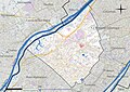
 Map commune FR insee code 92050.png 756 × 605; 102 KB
-

-
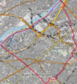
 Nanterre OSM 01.png 548 × 499; 437 KB
-
 Nanterre OSM 02.png 382 × 415; 330 KB
-
 Nanterre OSM 03.png 382 × 415; 207 KB
-
 Puteaux.Rond-Point des Bergeres.jpg 647 × 290; 58 KB


_dans_son_EPT_de_Paris_Ouest_La_D%C3%A9fense_au_sein_de_la_M%C3%A9tropole_du_Grand_Paris.png)


