Category:Old maps of New York City
Subcategories
This category has the following 15 subcategories, out of 15 total.
B
M
Q
R
S
Media in category "Old maps of New York City"
The following 200 files are in this category, out of 282 total.
(previous page) (next page)-
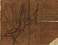
 (New York Island. Military; unfinished. LOC gm71002309.tif 3,341 × 5,066; 48.42 MB
-
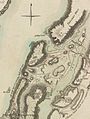
 (Plan de New-York et les environs. LOC gm71000992.jpg 6,419 × 4,992; 4.03 MB
-
 (Plan de New-York et les environs. LOC gm71000992.tif 6,419 × 4,992; 91.68 MB
-
 Plan of New York or New Amsterdam (as in Sept 1661), 1664 - BL.jpg 1,645 × 1,312; 951 KB
-

-
 Forts Washington Tryon Cockhill.jpg 1,356 × 1,798; 1.13 MB
-
 1820 Map of Manhattan.jpg 2,261 × 1,626; 498 KB
-
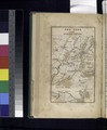
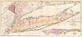 1842 Mather Map of Long Island, New York - Geographicus - LongIsland-mather-1842.jpg 6,000 × 2,732; 3.63 MB
-

-
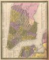 1850 Mitchell Map of New York City - Geographicus - NewYorkCity-mitchell-1850.jpg 2,500 × 3,096; 2.78 MB
-

-
-

-

-

-

-

-

-
 1862 Johnson Map of New York City and Brooklyn - Geographicus - NYC-johnson-1862.jpg 5,000 × 3,198; 5.79 MB
-
 1863 McCloskey Pocket Map of Brooklyn, New York - Geographicus - Brooklyn-mccloskey-1863.jpg 5,000 × 4,149; 4.16 MB
-
 1864 Mitchell Map of New York City, New York - Geographicus - NewYorkCity-mitchell-1864.jpg 3,000 × 3,695; 2.75 MB
-
 New York and Vicinity as Proposed to be Remodeled crop.png 766 × 472; 897 KB
-

-
 1865 Johnson Map of New York City and Brooklyn - Geographicus - NewYorkCity-johnson-1865.jpg 4,000 × 2,573; 3.29 MB
-
 1866 Johnson Map of New York City and Brooklyn - Geographicus - NewYorkCity-johnson-1866.jpg 3,620 × 5,000; 6.72 MB
-

-

-

-

-

-
 1867 Mitchell Map of New York City, New York - Geographicus - NewYorkCity-mitchell-1870.jpg 5,000 × 3,291; 5.13 MB
-
 1869 Kitchen - Shannon Map of New York City - Geographicus - NewYorkKitchin-mcny-1869.jpg 2,457 × 3,028; 1.05 MB
-

-
 New York City NYPL1575777.tiff 5,122 × 6,412; 93.96 MB
-

-
 1873 Central Park Map Harlem Meer.jpg 4,320 × 5,372; 10.25 MB
-

-

-

-
-

-
 1882 Mitchell Map of New York City, New York - Geographicus - NewYorkCity-mitchell-1882.jpg 4,000 × 2,611; 3.46 MB
-

-
 (King1893NYC) pg012 DUTCH MAP OF NEW YORK, 1656.jpg 1,245 × 1,981; 1.32 MB
-
 (King1893NYC) pg021 THOMAS KITCHIN (SENIOR'S) NEW YORK IN 1778, FROM THE LONDON MAGAZINE.jpg 1,285 × 1,714; 1.37 MB
-
 1895 Bien Map of New York City (w- Queens ^ the Bronx) - Geographicus - NYC-bien-1895.jpg 3,532 × 5,000; 3.73 MB
-

-

-
 1910 NYC map.jpg 1,694 × 2,288; 1.46 MB
-

-
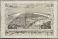
 Greatest New York (panoramic view) - H. Wellge, sk. NYPL1691404.tiff 7,230 × 4,118; 85.18 MB
-
 PSM V88 D089 Plan to enlarge new york city.png 2,041 × 2,871; 1.44 MB
-

-

-
-
 A plan of New York Island... (2675109076).jpg 1,290 × 2,000; 1.99 MB
-
 A plan of the city of New York from an actual survey, anno Domini, M(D)CC,LV LOC 73691802.tif 8,396 × 4,538; 109.01 MB
-

-
 Admiralty Chart No 2491 New York Harbour, Published 1857.jpg 11,307 × 8,029; 15.4 MB
-
 African Burial Ground - African Burial Ground National Monument, New York LOC 2011587283.jpg 10,305 × 4,934; 7.5 MB
-
 African Burial Ground - African Burial Ground National Monument, New York LOC 2011587283.tif 10,305 × 4,934; 145.47 MB
-
 African Burial Ground - African Burial Ground National Monument, New York LOC 2012585155.jpg 10,289 × 4,866; 6.88 MB
-
 African Burial Ground - African Burial Ground National Monument, New York LOC 2012585155.tif 10,289 × 4,866; 143.24 MB
-
 AmCyc New York City and Vicinity.jpg 1,546 × 2,437; 1.49 MB
-
 Annual report of the New York Zoological Society" (1897-) (18742531524).jpg 1,426 × 2,622; 571 KB
-
 Area District Map Section No. 6 NYPL1637938.tiff 7,230 × 5,428; 112.28 MB
-

-
 Plan of New York, &c (NYPL b13663520-1510801).tiff 5,246 × 6,298; 95.18 MB
-
 Bay and harbor of New York. NYPL1692341.tiff 7,050 × 9,300; 187.61 MB
-
 Birds eye view New York City crop.jpeg 682 × 450; 83 KB
-
 Birds eye view New York City.jpeg 5,662 × 4,066; 5.57 MB
-
 Birds-eye view of New York City (2675842338).jpg 2,000 × 1,370; 2.24 MB
-
 Britannica New York City.png 2,169 × 3,088; 560 KB
-
 Bronx1867.jpg 1,000 × 1,195; 265 KB
-
-
 BrooklynMap1766 Wallabout Bay.jpg 1,822 × 1,570; 1.56 MB
-
 BrooklynMap1766.jpg 1,882 × 1,629; 3.11 MB
-

-

-

-

-

-

-

-

-
 City of New York, 1843. NYPL433767.tiff 4,840 × 5,627; 77.94 MB
-
 City of New York. Board of Estimate and Apportionment. Area District Map. NYPL1637932.tiff 7,230 × 5,428; 112.28 MB
-
 City of New York. Board of Estimate and Apportionment. Height District Map. NYPL1637894.tiff 7,230 × 5,428; 112.28 MB
-
 City of New York. Board of Estimate and Apportionment. Use District Map. NYPL1637969.tiff 7,230 × 5,428; 112.28 MB
-
 City of New-York - by David H. Burr. NYPL1253197.tiff 4,557 × 5,094; 66.42 MB
-
 City of New-York - by David H. Burr. NYPL434685.tiff 4,944 × 5,835; 82.54 MB
-
 City of New-York - by David H. Burr. NYPL434686.tiff 4,784 × 5,915; 80.97 MB
-
 City of New-York - W. Kemble. NYPL434105.tiff 4,127 × 5,033; 59.43 MB
-
 City of New-York LOC 2005626401.jpg 5,604 × 6,905; 7.28 MB
-
 City of New-York LOC 2005626401.tif 5,604 × 6,905; 110.71 MB
-

-
 City of New-York. LOC 75692381.jpg 4,738 × 5,720; 3.91 MB
-
 City of New-York. LOC 75692381.tif 4,738 × 5,720; 77.54 MB
-
 Classified Business Directory of New York (1) NYPL1575811.tiff 5,142 × 6,444; 94.8 MB
-
 Classified Business Directory of New York (10) NYPL1575820.tiff 5,068 × 6,326; 91.73 MB
-
 Classified Business Directory of New York (11) NYPL1575821.tiff 5,100 × 6,482; 94.58 MB
-
 Classified Business Directory of New York (12) NYPL1575822.tiff 5,162 × 6,326; 93.43 MB
-
 Classified Business Directory of New York (13) NYPL1575763.tiff 5,134 × 6,490; 95.33 MB
-
 Classified Business Directory of New York (2) NYPL1575812.tiff 4,998 × 6,334; 90.57 MB
-
 Classified Business Directory of New York (3) NYPL1575813.tiff 5,134 × 6,506; 95.57 MB
-
 Classified Business Directory of New York (4) NYPL1575814.tiff 5,006 × 6,318; 90.49 MB
-
 Classified Business Directory of New York (5) NYPL1575815.tiff 5,166 × 6,514; 96.28 MB
-
 Classified Business Directory of New York (6) NYPL1575816.tiff 5,030 × 6,350; 91.38 MB
-
 Classified Business Directory of New York (7) NYPL1575817.tiff 5,134 × 6,404; 94.07 MB
-
 Classified Business Directory of New York (8) NYPL1575818.tiff 5,022 × 6,342; 91.12 MB
-
 Classified Business Directory of New York (9) NYPL1575819.tiff 5,120 × 6,466; 94.72 MB
-
 Colton's New York City - Brooklyn, Jersey City, Hoboken, etc. LOC 00557441.jpg 5,186 × 7,519; 6.98 MB
-
 Deep sea fishing grounds (1915) (20223273974).jpg 2,992 × 1,854; 940 KB
-
 Deep sea fishing grounds (1915) (20853022211).jpg 2,992 × 1,884; 1.49 MB
-
 Detail of Battle Of Fort Washington Map By Sauthier.jpg 1,018 × 841; 443 KB
-
-

-
 Disegno della struttura delle vie di Garden city.png 277 × 381; 188 KB
-
 District map of the Archdeaconry of New York. LOC 76692291.jpg 17,416 × 4,770; 14.09 MB
-
 District map of the Archdeaconry of New York. LOC 76692291.tif 17,416 × 4,770; 237.68 MB
-
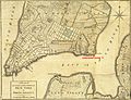
 Eldridge Street in A Plan of the City of New York (1776).jpg 1,900 × 1,499; 899 KB
-

-
 General Grant National Memorial, New York LOC 2010588606.jpg 5,277 × 4,879; 3.65 MB
-
 General Grant National Memorial, New York LOC 2010588606.tif 5,277 × 4,879; 73.66 MB
-
 Governors Island National Monument, New York LOC 2008620938.jpg 5,246 × 4,859; 3.84 MB
-
 Governors Island National Monument, New York LOC 2008620938.tif 5,246 × 4,859; 72.93 MB
-
 Governors Island National Monument, New York LOC 2009575006.jpg 5,319 × 4,841; 4.31 MB
-
 Governors Island National Monument, New York LOC 2009575006.tif 5,319 × 4,841; 73.67 MB
-
 Governors Island National Monument, New York LOC 2010588359.jpg 5,246 × 4,861; 3.73 MB
-
 Governors Island National Monument, New York LOC 2010588359.tif 5,246 × 4,861; 72.96 MB
-
 Gray's aero view of the port of New York LOC 2010587908.jpg 5,084 × 8,456; 5.83 MB
-
 Gray's aero view of the port of New York LOC 2010587908.tif 5,084 × 8,456; 123 MB
-
 Guide leaflet (1901) (14579642887).jpg 2,040 × 1,780; 344 KB
-
 Hammond's new guide map of Manhattan and the Bronx. LOC 79695063.jpg 10,597 × 11,271; 24.18 MB
-
 Hammond's new guide map of Manhattan and the Bronx. LOC 79695063.tif 10,597 × 11,271; 341.72 MB
-
 Historic lower Manhattan LOC 79690008.jpg 5,368 × 6,891; 3.96 MB
-
 Historic lower Manhattan LOC 79690008.tif 5,368 × 6,891; 105.83 MB
-
 History of the city of New York- its origin, rise and progress (1896) (14760892714).jpg 1,758 × 3,338; 1.71 MB
-

-

-
 John Randel Map Detail of Kings Bridge.jpg 3,494 × 2,329; 4.48 MB
-
 Joseph Hutchins Colton - City of New York - 1897 - 001.jpg 5,000 × 2,786; 7.79 MB
-
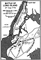
 Long Island 1842.jpg 701 × 313; 212 KB
-
 Maerschalck Map-Negros Burial Ground-1755.jpg 554 × 767; 127 KB
-

-
 Manhattan1781.jpg 864 × 1,680; 893 KB
-
 Map of Kings and part of Queens counties, Long Island N.Y. LOC 2013593245.jpg 16,957 × 16,034; 44.92 MB
-
 Map of Kings and part of Queens counties, Long Island N.Y. LOC 2013593245.tif 16,957 × 16,034; 777.88 MB
-
 Map of New York and Adjacent Cities NYPL1691419.tiff 7,230 × 5,428; 112.28 MB
-
 Map of New York and vicinity. LOC 2015591056.jpg 7,068 × 11,369; 11.67 MB
-
 Map of New York and vicinity. LOC 2015591056.tif 7,068 × 11,369; 229.9 MB
-

-

-

-
 Map of New York City. LOC 77693691.jpg 5,136 × 15,597; 12.71 MB
-
 Map of New York City. LOC 77693691.tif 5,136 × 15,597; 229.19 MB
-

-

-

-
 Map of New York WDL9593.png 1,368 × 1,024; 2.32 MB
-
 Map of New York's Collect Pond, and adjoining streets, 1796.png 1,280 × 800; 508 KB
-
 Map of New York, Brooklyn, Jersey City etc NYPL1691418.tiff 7,230 × 5,428; 112.28 MB
-
-

-
 Map of New-York City LOC 80695174.jpg 9,802 × 7,753; 11.12 MB
-
 Map of the city of New York. LOC 2011593667.jpg 3,262 × 4,709; 2.93 MB
-
 Map of the city of New York. LOC 2011593667.tif 3,262 × 4,709; 43.95 MB
-
-

-
-
 Meyers b12 s0121a.jpg 1,638 × 2,048; 773 KB
-
 Miller's new map of the city of New-York. LOC 2015591066.jpg 8,883 × 5,141; 7.56 MB
-
 Miller's new map of the city of New-York. LOC 2015591066.tif 8,883 × 5,141; 130.66 MB
-

-
 Minuit Chart.tif 4,284 × 2,951; 37.26 MB
-

-

-

-

-
 New york 1840.jpg 6,336 × 5,202; 3.88 MB
-
 New York 1901.jpg 5,416 × 9,675; 6.62 MB
-
 New York and adjacent country. NYPL433876.tiff 2,320 × 2,802; 18.6 MB
-
 New York and Perthamboy Harbours. NYPL434637.tiff 4,746 × 5,580; 75.79 MB
-
 New York and vicinity. NYPL433766.tiff 4,880 × 5,475; 76.46 MB
-
 New York City 1846.jpg 4,784 × 5,797; 4.25 MB
-
 New York City Business Notices - List of Attorneys, Bankers etc NYPL1517299.tiff 6,299 × 4,592; 83.41 MB
-
 New York med trakten däromkring. NYPL1030055.tiff 2,093 × 2,826; 16.95 MB
-
 New york retreat 1776 (2).jpg 413 × 607; 121 KB
-
 New york retreat 1776.jpg 893 × 1,250; 162 KB
-
 New York und Umgebungen. NYPL1030054.tiff 2,850 × 2,033; 16.58 MB
-
 New York1890.jpg 5,930 × 9,245; 6.61 MB
-

-
 Noort Rivier in Niew Neerlandt. LOC 2003623406.jpg 7,051 × 5,104; 5.54 MB
-
 NSRW New York City - environs.jpg 1,204 × 1,026; 699 KB
-
 NYC1776 crop.jpg 2,706 × 2,545; 4.65 MB
-
 NYC1776 labelled.jpg 4,360 × 3,360; 7.88 MB
-
 NYC1885-1.jpg 3,015 × 4,307; 8.78 MB
-

-

-

,_1664_-_BL.jpg)


_-_Geographicus_-_NewYork33Miles-colton-1848.jpg)

_-_Geographicus_-_NewYork33Miles-colton-1853.jpg)
_-_Geographicus_-_NewYork33MilesAround-colton-1855.jpg)
_-_Geographicus_-_NewYorkCity-colton-1855.jpg)


_-_Geographicus_-_NewYorkCity-colton-1866.jpg)


_-_Geographicus_-_NewYorkArea-beers-1867.jpg)


_-_Geographicus_-_NewYork-uscs-1874.jpg)

_-_Geographicus_-_NYC33Miles-colton-1879.jpg)


_pg012_DUTCH_MAP_OF_NEW_YORK,_1656.jpg)
_pg021_THOMAS_KITCHIN_(SENIOR%27S)_NEW_YORK_IN_1778,_FROM_THE_LONDON_MAGAZINE.jpg)
_-_Geographicus_-_NYC-bien-1895.jpg)
_-_Geographicus_-_NYC-HomeLife-1899.jpg)
_-_Geographicus_-_NewYork-woodharmon-1906.jpg)


%27_(11005117474).jpg)
%27_(11117498305).jpg)
.jpg)
_(14780445202).jpg)


_(18742531524).jpg)


.jpg)


_(20223273974).jpg)
_(20853022211).jpg)

,_the_mouth_of_Newtown_Creek,_and_the_Anable_Basin.png)
_(14756077211).jpg)

.jpg)


_(14579642887).jpg)


_(14760892714).jpg)
_(14581608779).jpg)


_Map_J_Vinckeboons_1639_(LOC_97683586).jpg)


_(14591423149).jpg)
_(14755081696).jpg)


.jpg)


_1837;_containing_a_general_description_of_the_city_of_New-York,_list_of_officers,_public_institutions,_and_other_useful_information_(1833)_(14781464764).jpg)


.jpg)
.jpg)
.jpg)
.jpg)