Atlas of Vietnam

|
Wikimedia Commons Atlas of the World The Wikimedia Atlas of the World is an organized and commented collection of geographical, political and historical maps available at Wikimedia Commons. Discussion • Update the atlas • Index of the Atlas • Atlas in categories • Other atlases on line |
|
| ||||||||||||||||||||||||||||||||||||||||||


General maps

|
Map of Vietnam (in Vietnamese). Includes island claims. |

|
Map of Vietnam (in English). Includes island claims. |

|
Map of Vietnam from the CIA World Factbook. |

|
Map of Vietnam from the CIA World Factbook (translated to Vietnamese). |

|
Political map of Vietnam. |

|
A map showing Vietnam's cities and main towns. |

|
Satellite image of Vietnam. |

|
Köppen–Geiger climate classification map for Vietnam. |

|
Outlines of Geological Map of Vietnam of sclale 1:1 000 000. |

|
Topographic map of Vietnam. |

|
Regions of Vietnam by HDI in 2018. |

|
Map poverty rates by district of vietnam in 2010 and 2014 |

|
Ethnolinguistic groups of Vietnam in 1970. |

|
Map of Vietnam's railway network. |

|
Map of Vietnam's expressway network. |
Maps of divisions
This section holds maps of the administrative divisions.

|
Map of Vietnam administrative divisions. Includes island claims. |

|
Map of the Regions of Vietnam. |

|
Map of the Provinces of Vietnam (in Vietnamese) |

|
Districts of Vietnam. Includes island claims. |
Provincial locator maps
-
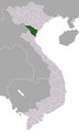
 An Giang
 -
 Bac Giang
 -
 Bac Kan
 -
 Bac Lieu
 -
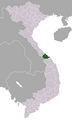
 Bac Ninh
 -
 Ba Ria-Vung Tau
 -
 Ben Tre
 -
 Binh Dinh
 -
 Binh Duong
 -
 Binh Phuoc
 -
 Binh Thuan
 -
 Ca Mau
 -
 Can Tho
 -
 Cao Bang
 -
 Dak Lak
 -
 Dak Nong
 -
 Da Nang
 -
 Dien Bien
 -
 Dong Nai
 -
 Dong Thap
 -
 Gia Lai
 -
 Ha Giang
 -
 Ha Nam
 -
 Hai Duong
 -
 Hai Phong
 -
 Hanoi
Hanoi -
 Hau Giang
 -
 Ha Tay
 -
 Ha Tinh
 -
 Hoa Binh
 -
 Ho Chi Minh City
 -
 Hung Yen
 -
 Khanh Hoa
 -
 Kien Giang
 -
 Kon Tum
 -
 Lai Chau
 -
 Lao Cai
 -
 Lam Dong
 -
 Lang Son
 -
 Long An
 -
 Nam Dinh
 -
 Nghe An
 -
 Ninh Binh
 -
 Ninh Thuan
 -
 Phu Tho
 -
 Phu Yen
 -
 Quang Binh
 -
 Quang Nam
 -
 Quang Ngai
 -
 Quang Ninh
 -
 Quang Tri
 -
 Soc Trang
 -
 Son La
 -
 Tay Ninh
 -
 Thai Binh
 -
 Thai Nguyen
 -
 Thanh Hoa
 -
 Thua Thien-Hue
 -
 Tien Giang
 -
 Tra Vinh
 -
 Tuyen Quang
 -
 Vinh Long
 -
 Vinh Phuc
 -
 Yen Bai


History maps
This section holds a short summary of the history of the area of present-day Vietnam, illustrated with maps, including historical maps of former countries and empires that included present-day Vietnam.
Ancient period
.png)
|
Âu Việt (Xi Ou) and Lạc Việt (Luo Yue) (210 BC). |

|
Map of Nanyue Kingdom at its greatest territorial extent. |
Chinese domination

|
North Vietnam ruled by Han Dynasty 2 CE. |
.png)
|
Vietnam under the reign of Emperor Wu of Han. |

|
Eastern Han dynasty period, 189 CE. |

|
Han Dynasty in 219 CE. |

|
Giao Chau (Jiaozhou) ruled by the Eastern Wu, 264. |

|
North Vietnam ruled by the Western Jin Dynasty 280 AD. |

|
Eastern Jin Dynasty 382 AD. |

|
Jiaozhou in the Southern Qi Dynasty (497). |

|
Vạn Xuân kingdom during Early Lý dynasty (544 - 602). |

|
Sui Dynasty 610 A.D. |

|
Vietnam under the Chinese Tang Dynasty |
Monarchical period

|
Khúc clan 923 CE |

|
Circuits and cities of Annan, Ngô Dynasty, as of 940. |

|
Period of the 12 Warlords |

|
Đại Việt during Lý Dynasty c. 1085. |

|
Đại Việt c. 1111. |

|
Asia in 1290. |
.png)
|
Dai Viet c. 1428. |

|
Đại Việt c. 1480. |

|
Vietnam circa 1540 |

|
Vietnam circa 1570 showing the Mac in control of the land north of the Red river, and the Nguyen-Trinh alliance in control of the southern part of Vietnam. |

|
Vietnam around 1650. |

|
Đại Việt (Annam) during the Later Lê Dynasty in 1760. |
.png)
|
Vietnam around 1788. |
.png)
|
Vietnam around 1834. |
.svg)
|
Vietnam around 1838. |

|
Vietnam around 1857. |
.gif)
|
Southward expansion (Nam Tien) of the Dai Viet Empire. |
Modern period

|
Map of French Indochina. |

|
Tonking, Östl. Hinterindien, Hue, Ha-Noi (Meyers Konversationslexikon), 1888. |
.png)
|
Indochina in 1905 (German). |

|
Indochina in 1931 (Czech). |

|
French Indochina, 1954. |

|
The drawing shows the French disposition at the Battle of Dien Bien Phu, as of March 1954. The French took up positions on a series of fortified hills (shown in green). The southermost, Isabelle, was dangerously isolated. The Viet Minh positioned their 5 divisions (the 304th, 308th, 312th, 316th, and 351st) in the surrounding areas to the north and east. From these areas, the Vietminh had a clear line of sight on the French fortifications and were able to accurately rain down artillery on the French positions. |

|
Map of the Japanese Empire (1870-1942) |
North Vietnam (1954–1976)

|
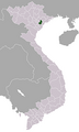
Locator map of North Vietnam. |

|
Map of North Vietnam, the Democratic Republic of Vietnam (Việt Nam Dân Chủ Cộng Hòa). |
South Vietnam (1954–1976)

|
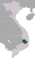
Locator map of South Vietnam (Nam Việt Nam). |

|
Map of South Vietnam. |

|
Map of South Vietnam, the Republic of Vietnam (Việt Nam Cộng Hòa) in 1967. |

|
Map of the Tet Offensive. |
Other historical maps

|
Animated map of the history of railway construction in Vietnam, 1881–1966. |

|
Map of the Sino–Vietnamese War (Third Indochina War), 1979. |
Old maps
This section holds copies of original general maps more than 70 years old.

|
Early Western Map of Tonkin (1651). |
Notes and references
|
General remarks:
|